

¡El Tour
Budget Bicycle Tours in Mexico
www.BikeMexico.com
The Complete Archive · 2000–2020

Yucatan to the Clouds 2005
Season 2004–2005 · all tours that season
The long one. On this CHALLENGE difficulty tour we cover about 1300km in 3½ weeks from Cancun to San Cristóbal, Chiapas. We start with easy spinning along very flat terrain, gradually moving on to rolling countryside and finally climbing to 2200m in the midst of the exhilarating Sierra Madres of Chiapas. Highlights include Caribbean beaches, caves and cenotes, Mayan ruins, small friendly villages, colonial cities and enchanting mountains.
| Dates: | Thurs Feb 10, 2005 to Sun Mar 6, 2005 (3½ weeks - 17 cycling days) |
| Distances: | Average/day: 81km Maximum/day: 133km Total Approx: 1383km |
| Route Type: | CHALLENGEChallenge DifficultyYou need to have excellent fitness and good cycling experience. Distances generally average about 70 - 110 km per day (depending on hills), and are always less than 150 km. Roads range from flat to Sierra Madre (mountainous!). We may climb up to 3000 metres in a day.WeatherThe Weather: Yucatan PeninsulaThe Yucatan's best weather is during our winter months. From November till March the temperature hovers in the mid 20's to the mid 30's (celcius) with sunny clear skies. Humidity levels can be high as we head inland but a warm steady breeze and the occasional but rare tropical thunderstorm will keep you feeling refreshed.RoadThe Road: Yucatan PeninsulaThe Yucatan's roads are considered the finest in Mexico. They are generally in excellent condition with even, paved surfaces. Some stretches of our route also include a paved shoulder. The route meanders along flat terrain with the occasional rolling section. In most places traffic is light to non-existent. Depending on the time of day, roads may be busy near towns such as Cancun, Valladolid and Merida, however drivers are generally respectful of cyclists and will give you as much room as possible.LandThe Land: Yucatan PeninsulaThe Yucatan peninsula at the south eastern tip of Mexico is comprised of three states, Campeche, Yucatan, and Quintana Roo. The peninsula is a massive, flat carbonate - limestone shelf formed by prehistoric high sea levels. Too porous to support a river system, fresh water accumulates underground forming an extensive subterranean river network. Where the erosive process has broken through the earth's surface, cenotes (se-no-tes; limestone sinkholes or pools) have formed. Erosion has also formed numerous caves, some of them enormous and accessible to tourists. The peninsula's landscape is covered by thorn forest in the north and rain jungle in the south.WeatherThe Weather: ChiapasChiapas is best enjoyed during the winter months - harldy a day goes by without clear blue skies and sunshine. Because of the altitude in the mountains, the nights occasionally dip down to freezing, but the days quickly heat up and you'll be changing back into your shorts by late morning. It's pleasantly dry in the winter, and most of the rainfall necessary to keep the impressive jungles and forests green comes in the summer.RoadThe Road: ChiapasThe roads in Chiapas are generally in excellent condition. Our route in Chiapas is hilly and mountainous with long climbs and descents as well as numerous switchbacks. In most places, traffic is light to non-existent and consists mostly of taxis, small trucks and buses. At certain times of day the roads are busy in and near San Cristobal, however drivers are generally respectful of cyclists and will give you as much room as possible.LandThe Land: ChiapasChiapas is a tangle of majestic pine-clad mountains and humid dense jungle. Most of the country's natural resources are right here in the country's poorest state. Its mountains offer unbelievable views and splendid rivers and waterfalls flow out of them. |
| Highlights: | Challenging cycling. Beaches, ruins, small towns, history, colonial towns, mountains, waterfalls. A diverse cross-section of Mexico. |
The Route
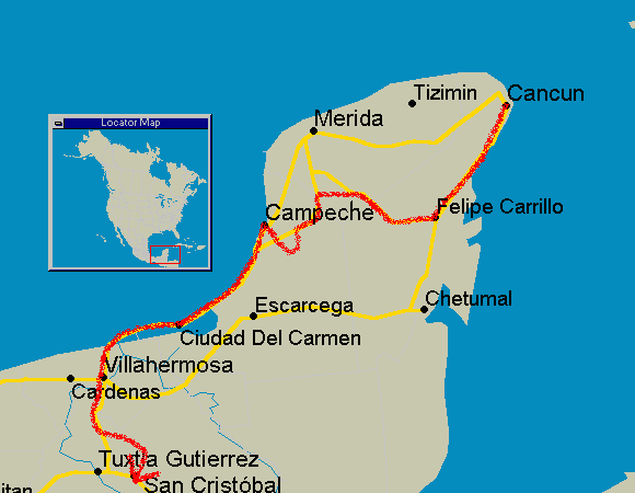
Itinerary
Click any day for the full description. Itineraries were always subject to minor changes.
WhenWhereDistanceHighlights
Day 0Meet in Cancun-
Beaches, Bars, Discos, Clubs, Cuisine [more]
A fishing village of 120 people as recently as 1970, Cancun is today Mexico's biggest resort. There are in fact two distinct cities: the ZONA COMMERCIAL on the mainland - where the Mexicans live and the ZONA HOTELERA, an L-shaped island connected by bridges to the mainland - where the tourists live. Cancun island�s magnificent, silky white beaches and warm turquoise waters are lined with huge, luxury hotels, flashy discos, and neon clad nightclubs and restaurants. Once settled into our hotel room, we will experience some of the Yucatan�s delicious culinary tradition at one of Cancun�s numerous restaurants. The rest of the evening can be spent relaxing on the mainland with the Mexicans, or enjoying the nightlife in the Hotel Zone.Day 1Cancun to Playa del Carmen88 km
Beach, Scuba-Diving, Snorkeling [more]
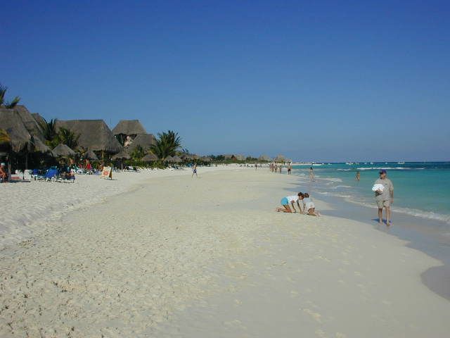
This former, sleepy fishing village, with its silky white sand, gentle surf, coral reefs, and startling emerald green waters is as close as you can come to paradise on earth. Playa's narrow streets are clogged with young shoppers and backpackers. Predominantly from Italy, France and Germany, they have come to enjoy its beautiful beaches and its lively nightlife.Day 2Playa del Carmen to Tulum61-74 km
Cenotes, caves, beach, camping possible [more]
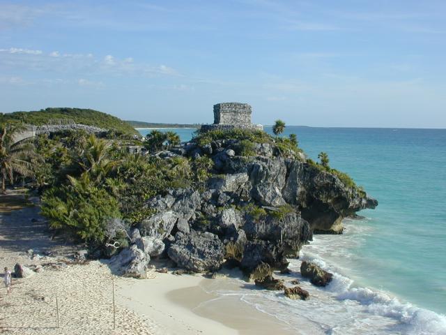
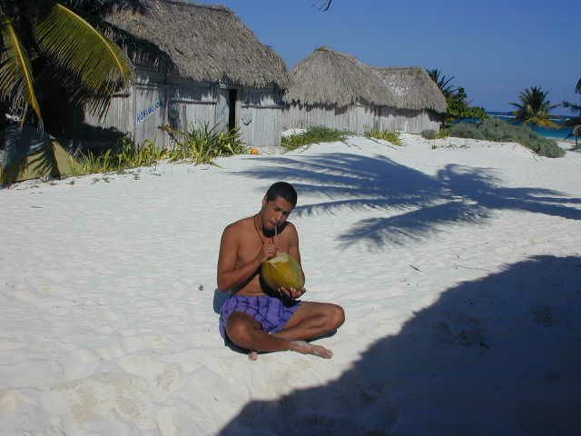
Today we have the opportunity to explore any of a number of enchanting cenotes including Dos Ojos, Cenote Azul and several more as well as the impressive Aktun Chen caves. In Tulum we get to enjoy the two aspects of the Yucatan that make it a special place to visit; its archaeological wonders and the Caribbean sea. Tulum was the oldest continuously inhabited city in the New World when the Spanish first discovered it. It was first settled in the 4th century AD. Today, international travelers and sun worshippers have invaded this ancient city. We will spend our nights in Tulum sleeping on the beach in a cabaña (a thatched roof hut) with the soothing sounds of the surf lulling us to sleep.Day 3Tulum-
After the ruins, why not go for a scuba dive or a snorkel, or perhaps you'd like to learn how to dive?
Beach, snorkel, Scuba-Diving, Tulum ruins, camping possible [more]
It's best to tour the ruins first thing in the morning before the tourists and the heat overwhelm. Its graying temples and watchtower rise above wind-bent palm trees clinging to a cliff overlooking the Caribbean Sea.After the ruins, why not go for a scuba dive or a snorkel, or perhaps you'd like to learn how to dive?
Day 4Tulum to Felipe Carillo Puerto105 km
Cenote, Sanctuary of the talking cross, Whipping Fountain, Mercado [more]
This dusty, crossroads market town is named after the assassinated hero who governed the Yucatan and worked for the liberation of the native Mayan indians. The original Maya settlement was named Chan Santa Cruz (Small Holy Cross) after a wooden cross, erected at a nearby cenote. According to local legend, the cross would speak to the Maya Indians, in their native tongue, encouraging them to resist their Spanish rulers. Today you can visit the cenote and a tiny museum at the site where the cross was located. In the town's zocalo you can also see a whipping fountain that was once used by the Maya elders as a place of punishment.Day 5Felipe Carillo Puerto to Jose Maria Morelos80 km
Small towns. [more]
J.M. Morelos is a small very typical Yucatecan town, except for the lack of tourism. Today and tomorrow takes us to parts unknow to tourists. You'll see how wonderfully friendly the people of the Yucatan really are.Day 6JM Morelos to Tekax93 km
Field of Aloe-Vera, rolling hills, charming towns. [more]
The town of Tekax is a gorgeous colonial town and a good launching pad to explore many more Mayan ruins in the Puuc Hills nearby.Day 7Tekax-
Rest day [more]
The town of Tekax is a gorgeous colonial town and a good launching pad to explore many more Mayan ruins in the Puuc Hills nearby.Day 8Tekax to Sta. Elena via Ruta Puuc70 km
Loltún cave, Mayan ruins and more Mayan ruins [more]
We will start our day with a short ride to Loltún cave; the most interesting and largest cave system in Yucat�n. Later we will explore the Mayan ruins of: Labná, Sayil and Kabáh. This is a pretty full day of Mayan ruins. Returning to Sta. Elena we can visit the museum with the mummies that they discovered buried under the church, then watch the sun set into the jungle from the hill that the church is set on.Day 9Sta. Elena and Uxmal Ruins29 km
Almost a rest day. Famous Uxmal Mayan ruins [more]
We will leave our baggage in Sta. Elena for an easy 14km ride to the famous Mayan ruin site of Uxmal. We'll arrive first thing in the morning so we can be the first ones in and tour the ruins at our liesure. Returning to Sta. Elena we can visit the museum with the mummies that they discovered buried under the church, then watch the sun set into the jungle from the hill the church is on.Day 10Sta. Elena to Hopelchen73 km
Mayan villages, cave [more]
We will pass through several small colonial but predominantly Mayan villages. We may also explore Xtacumbilxunaan cave... but you have to be able to pronounce the name first. Hopelchen; the place of 5 wells (in Mayan), is a charming and friendly little town. The Mennonites that occupy much of the surrounding regions buy and sell their produce in the market here.Day 11Hopelchen to Campeche (via Edzná, China)116 km
Mayan ruins, small villages, quiet roads [more]
We will visit the Mayan ruins of Edzná and pass through more small towns along quiet roads on the way to Campeche.Day 12Campeche-
Explore the walled, fortified colonial city. [more]
Campeche was once a Mayan trading village called Ah Kim Pech (Lord Sun Sheep-Tick). After 25 years of fierce Mayan resistance, the Spanish founded colonial Campeche in 1531, but later abandoned it due to Mayan hostility. Finally in 1540 Fransisco de Montejo the Younger gained sufficient control and founded a settlement that survived. It became a major port exporting timber, chicle, dyewoods, gold and silver to Europe. For nearly two centuries pirates terrorized Campeche, until finally in 1668, 3.5 metre thick ramparts were built. After 18 years of construction, a 2.5km hexagon incorporating eight strategically placed baluartes surrounded the city. Parts of the wall and the baluartes as well a couple of forts south of the city still exist and make for an interesting tour.Day 13Campeche to Sabancuy133 km
Deserted beaches, charming friendly town [more]
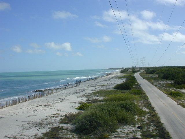
Welcome to the gulf coast. We'll enjoy many great views of the sea as the road meanders and rolls. In Sabancuy we'll yet again be overwhelmed by the local people's friendliness and hospitality. In the evening you may choose to wonder around town or take in a movie at the very unlikely 350 seat movie theatre - it's a little large for the size of the town.Day 14Sabancuy to Ciudad del Carmen85 km
Gulf coast, deserted beaches, bustling exciting city [more]
Today will be our last opportunity to swim in the sea, and we'll find a nice quiet beach to stop at - heck we'll be riding along the beach for most of the day! Ciudad del Carmen is a busy, bustling, exciting city used by Pemex, Mexico's national petrolium company, as a jumping off point to the many oil platforms in the gulf.Day 15Ciudad del Carmen to Frontera97 km
Quiet roads, small towns and villages. [more]
Today we officially leave the Yucatan peninsula and cross over into the state of Tabasco. Once again the landscape changes and now we are surrounded by wetlands as we pass through small quiet towns. Frontera is an interesting lively town. Fishing is an industry here, and it's very much a port town, but the market and the square will keep you entertained and very well fed.Day 16Frontera to Villahermosa83 km
The wetlands of the state of Tabasco. [more]
Crossing over the confluence of the Usumacinta (which forms much of the border with Guatemala) and the Grijalva rivers, we now head more inland only to once again meet up with the Grijalva in Villahermosa. This is a hot, crowded, untidy and exciting city.Day 17Villahermosa-
La Venta park; Olmec archeological museum, Tabasco zoo. Exciting bustling city. [more]
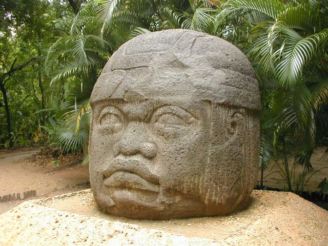
Our last rest day before the final stretch. Tomorrow we head for the mountains. Villahermosa is an interesting if exhausting city to explore, for a break from the city you might want to head for Parque-Museo La Venta. The ancient (before 600 BC) Olmec city of La Venta was actually on an island in a river some 130km west of Villahermosa. Several enormous basalt Olmec heads (the largest weighs 24 tonnes and stands over 2m tall) and other artifacts were discovered between 1925 and 1940. When oil excavation threatened the site, the most significant finds were moved to thier current home in Villahermosa in Parque-Museo La Venta. There is also a zoo here with everything from crocodiles to jaguars to spider monkeys. It's truly worth a visit.Day 18Villahermosa to Pichucalco78 km
A small town in the foothills of the mountains of Chiapas state. [more]
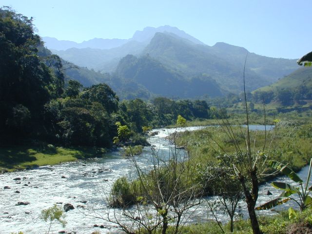
As we cycle past enormous banana plantation, the distant mountains suddenly come into view. Soon we're cycling up the rolling foothills seeing views of the vast plains below. We cross into Chiapas and Pichucalco is our first stop in the mountains, still at fairly low elevation.Day 19Pichucalco to Tapilula53 km
mountains
mountains
In the heart of the mountains. Challenging climbing. Amazing views and scenery. Small villages and towns. [more]
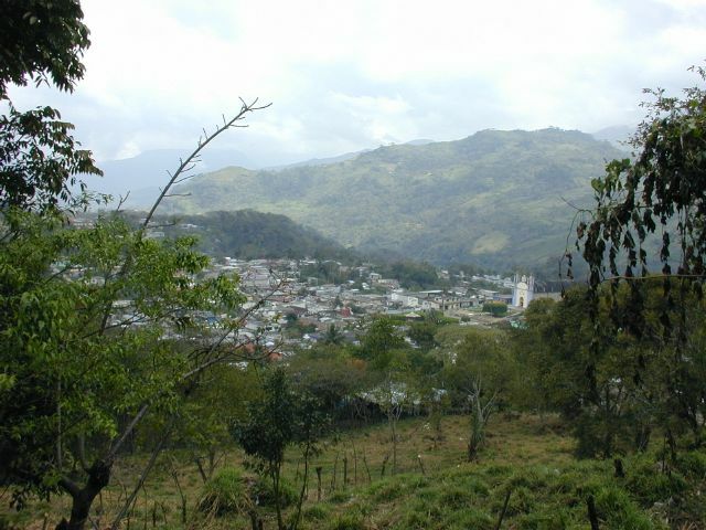
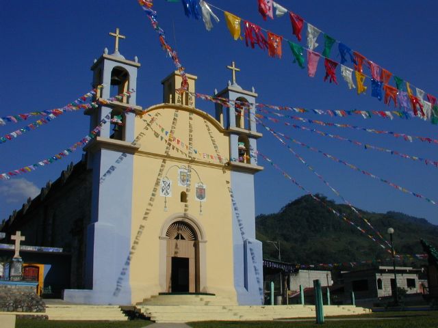
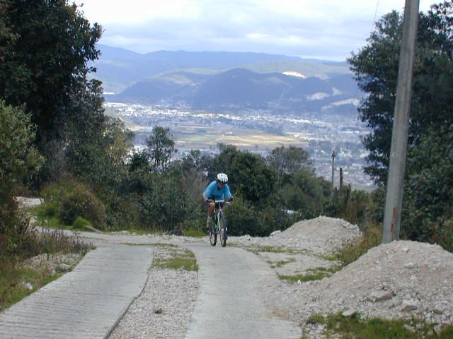
You'd better have a triple chainring on your bike for today and tomorrow. We're in for some very challenging steep climbs, with spectacular, rewarding views. Suddenly we find ourselves cycling in a canyon following the Puyacatengo river upstream. In Tapilula the children act as our ambassadors to this charming, friendly little colonial town. For a treat, try deepfried cheese stuffed in banana with cream on it! You deserve it.Day 20Tapilula to Jitotol52 km
mountains
mountains
Climbing higher into the mountains and yet more spectacular views. Small villages and towns. [more]
Resume climbing. It always seems to be foggy here, but perhaps it'll clear up and we can see what we've climbed over the last day and a half when we reach the lookout at the highest point of the day, 1800m. If the fog causes us to forfeit our distant views then we can instead marvel at how the fog oozes over the mountain pass from one series of valleys into another - it's a magical sight. Descending from the pass we meander our way along the sides of mountains to Jitotol, another unassuming quiet little highland town.Day 21Jitotol to San Cristóbal74 km
mountains
mountains
Spectacular Mountain Scenery, Villages, the Historic Old Town [more]
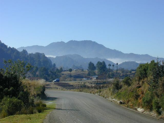
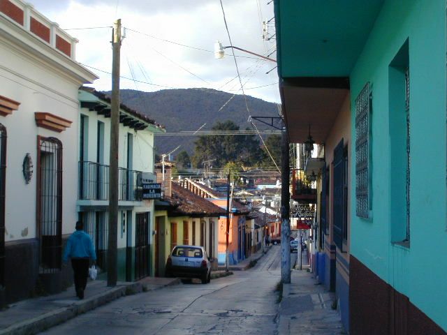
Even though the last ride of our tour is only 73km long, it is probably the most challenging and awe-inspiring stage of our journey. From sea level in Cancun the tour ends today at 2100m altitude in San Cristóbal de la Casas. On the way today we'll follow the winding road up and down and around mountain passes and valleys, pine forests and indigenous villages. This is Tzotzil-Maya country.Day 22Around San CristóbalOptional 30-60 km
mountains
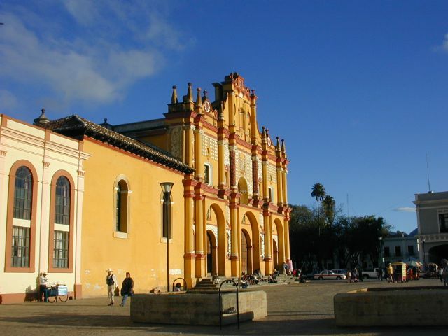
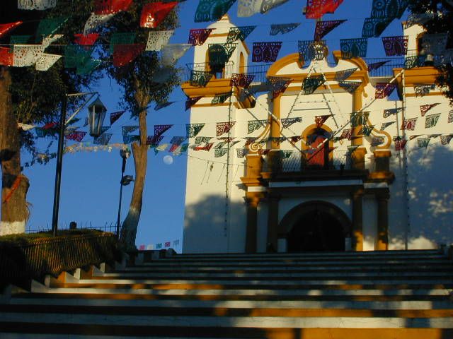
In San Cristóbal, the zocalo, or main square in the center of town, is a good starting point for exploring. From there you can visit the many churches and other historical buildings in the town's historic core. The mercado, San Cristóbal's daily food market is also well worth a visit. Around Santo Domingo church you will be able to buy authentic handcrafts at the artisan market.
At night, cafes and restaurants host live music into the night. There is also cinema with foreign and spanish language films, and it's rare for a week to go by without some kind of fiesta taking place.
mountains
Colonial Town, Markets - explore San Cristóbal [more]
You may explore San Cristóbal or ride to one or more nearby Maya villages and mountains.In San Cristóbal, the zocalo, or main square in the center of town, is a good starting point for exploring. From there you can visit the many churches and other historical buildings in the town's historic core. The mercado, San Cristóbal's daily food market is also well worth a visit. Around Santo Domingo church you will be able to buy authentic handcrafts at the artisan market.
At night, cafes and restaurants host live music into the night. There is also cinema with foreign and spanish language films, and it's rare for a week to go by without some kind of fiesta taking place.
Day 23San Cristóbal to Cancun-
Leave in the afternoon for Cancun, or stay a little longer! [more]
You will leave San Cristóbal on an overnight 1st class or deluxe bus for the trip back to Cancun. That is of course, unless you've fallen under the spell of this town like so many others and decide to stay a little longer.Day 24Cancun to home-
What it cost that season
| Guides' Fee | + Accommodations | + Food & Drink | + Misc. | = Approx. Total Land Cost |
|---|---|---|---|---|
| $700 | $220 | $250 | $170 | $1,340 |
All figures in US dollars, as published at the time. Riders paid their own accommodation, food and entrance fees on the road — the Guides' Fee was the only charge from ¡El Tour. Full history: price of Yucatan to the Clouds through the years.
Photo Album
















This tour in other seasons: 2005–2006