
¡El Tour
Budget Bicycle Tours in Mexico
www.BikeMexico.com
The Complete Archive · 2000–2020

Mountains & Natural Wonders 2004
Season 2003–2004 · all tours that season · Announced but season records end here
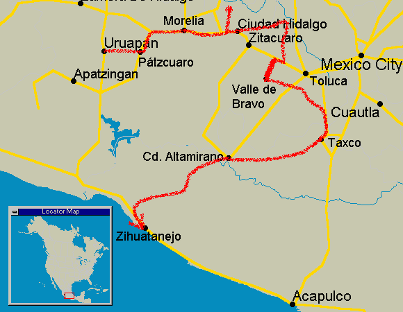
This CHALLENGE difficulty tour is entirely in the western Sierra Madre mountains of Mexico. It's VERY CHALLENGING! We will see volcanos, geothermal vents, the migration of the monarch butterfly, pine forests, colonial towns and more. We'll even visit the marble-paved streets of the birth village of the last Aztec emperor. After meeting in Zihuatanejo, we take the bus to Uruapan and then cycle back along a very scenic 3 week route.
Archive note: Listed as 'Mountains and Natural Wonders 2004' (US$995); dates not preserved.
| Dates: | not preserved — season 2003–2004 (3 weeks - 15 cycling days) |
| Distances: | Average/day: 74km Maximum/day: 121km Total Approx: 1111km Total climbing: 18000m |
| Route Type: | Very CHALLENGEChallenge DifficultyYou need to have excellent fitness and good cycling experience. Distances generally average about 70 - 110 km per day (depending on hills), and are always less than 150 km. Roads range from flat to Sierra Madre (mountainous!). We may climb up to 3000 metres in a day.WeatherThe Weather: MountainsLate fall and winter in the Mexican mountains is dry and cool. The sun warms things up during the daytime, but expect freezing temperatures overnight. High volcanoes can be snowcapped around this time.Spring is warmer, and in the summer it will often rain in the afternoon. RoadThe Road: MountainsThe road is generally in excellent condition. There are some sections of dirt road, and rough pavement. In the mountainous areas, the road rarely flattens out and occasionally climbs at more than a 10% grade, however in the high plateaus the road can be fairly flat to rolling. Traffic is generally light to non-existent, except of course close to larger towns and cities. The surface is generally wide and the drivers are courteous.LandThe Land: MountainsAltitudes generally range between 1500 and 2500m, however on some tours we may climb up over 4000m. The high volcanoes are snow-capped in the winter. The mountain vegetation varies greatly from humid cloud forests to cool dry pine forests or dry desert shrub. |
| Highlights: | Colonial cities and towns, mining towns, exquisite artesanias (crafts), mountains, forests, lakes, camping, geothermal vents and hot-pools, 4200m volcano climb, a massive cave system, the birthplace of Cuauhtémoc (last Aztec emperor) - a town with streets paved with marble, beaches. |
The route details, map and itinerary below are preserved from the 2005 edition of this tour — the closest surviving version of this route.
The Route
Itinerary
Click any day for the full description. Itineraries were always subject to minor changes.
WhenWhereDistanceHighlights
Day 0Meet in Zihuatanejo-
Small resort, beaches, night life, seafood. [more]
Zihuatanejo is Ixtapa's easy-going sibling. Only 8km away it still gets a lot of tourism but has a very different ambiance. Small-scale fishing is still important to the town's ecomony so seafood here is great. There are many good beaches, restaurants, bars and a very busy and colourful market.Day 1Zihua to Uruapan by bus-
Take the bus to the start of our bike tour - Uruapan [more]
Uruapan is the distribution center for much of the fruit produced in the state of Michoacan. To get an idea of what this means, consider that the most popular name for juice and refreshment stores in Mexico is 'Michoacan'. The name Uruapan means 'Eternal Spring' referring to the Río Cupatitzio which emerges in a gorge out of the 'Rodilla del Diablo' pool and runs through the city. At the Parque Nacional Eduardo Ruiz, we'll enjoy the lush vegetation, waterfalls and fountains where the river is born.Day 2Uruapan to Pátzcuaro69km
Highland colonial town. Museums, churches, markets. [more]
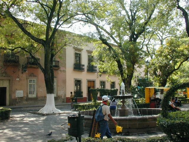
Cycling from Uruapan at 1620m elevation, we climb up over 2000m where we'll be staying for much of the tour. Pátzcuaro, at 2175m is a lovely colonial town, with several plazas, museums, churches and markets. In 1536, the Catholic Church of Mexico City sent Bishop Vasco Quiroga to Patzcuaro to clean up the chaos that the cruelty of conquistador Nuño de Guzmán had created. He created village cooperatives, encouraging education and agricultural self-sufficiency in the villages surrounding Lago de Pátzcuaro. He also helped each village develop its own craft specialty, traditions that continue today. The indigenous people in this area are Purépecha; direct descendants of the Tarascos, who developed western Mexico's most advanced pre-Hispanic civilization.Day 3Around Lake Pátzcuaro70km
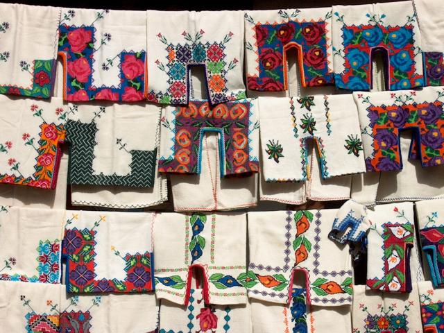
Bishop Vasco de Quiroga arrived in the area in 1536 and pioneered village cooperatives based on the humanitarian ideas of Sir Thomas More's Utopia. He promoted education and agriculture to avoid that the local people be dependent on Spanish lords and landowners. He also helped each village around the lake develop its own craft (artesania) specialty. The Utopian community declined after Quiroga's death, however the artesania traditions still continue today. Ihuatzio offers Tarascan ruins. Tzintzuntzan (Place of Hummingbirds) also has ruins (Las Yácatas), straw and wood carved crafts. Quiroga sells brightly painted wooden products, leatherwork and wool. Erongarícuaro's specialty is decorating furniture with beautiful hand-painted images. Tocuaro is known for wonderfully expressive, realistic and surrealistic masks.
Purépecha villages, artesanias, Tarascan ruins. [more]
We will ride around the Lago de Pátzcuaro and return to Pátzcuaro, so today we can ride unloaded.Bishop Vasco de Quiroga arrived in the area in 1536 and pioneered village cooperatives based on the humanitarian ideas of Sir Thomas More's Utopia. He promoted education and agriculture to avoid that the local people be dependent on Spanish lords and landowners. He also helped each village around the lake develop its own craft (artesania) specialty. The Utopian community declined after Quiroga's death, however the artesania traditions still continue today. Ihuatzio offers Tarascan ruins. Tzintzuntzan (Place of Hummingbirds) also has ruins (Las Yácatas), straw and wood carved crafts. Quiroga sells brightly painted wooden products, leatherwork and wool. Erongarícuaro's specialty is decorating furniture with beautiful hand-painted images. Tocuaro is known for wonderfully expressive, realistic and surrealistic masks.
Day 4Pátzcuaro to Morelia67km
Tarascan ruins, colonial city. [more]
Our ride takes us along the shores of the Lago de Patzcuaro through several towns and villages before climbing over the mountain pass and dropping down into beautiful colonial Morelia, Michoacan state's capital.Day 5Morelia-
Rest day. Colonial city, churches, museums, markets. [more]
We'll take a rest day before heading for more mountains. Here in Morelia, the capital of Michoacan state, you can spend the entire day wondering the streets in awe of the colonial architecture, exploring markets and musuems. Check out the cathedral in the main square that took more than a century, from 1640 to 1744 to build. Architecturally, it's a combination of Herreresque, baroque and neoclassical.Day 6Morelia to Mirador Atzimba55km
Pine forests, springs, waterfalls, mountain views, camping. [more]
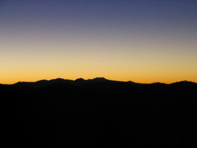
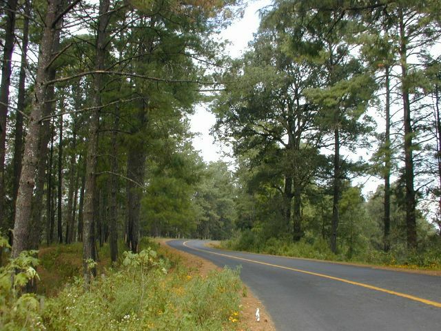
On the way out of Morelia, we'll see the 2km long, 253 arch impressive aqueduct that was built in 1785-1788 to meet the city's growing water needs. We will climb high through thick pine forests, past freshwater springs, waterfalls (you can actually drink the water!), and small friendly towns. The views along the way, while quite awesome, will pale in comparison to our destination, Mirador Atzimba. We will camp here, alone in the woods at almost 3000m elevation, perched on a lookout from where we can see several mountain peaks and valleys. You have never seen stars like this, not to mention the fabulous sunset and sunrise.Day 7Mirador Atzimba to San Pedro via Los Azufres77km
More views and forests. Geothermal vents, hot-springs. Small town. [more]
What goes up must come down... and then up again. Yesterday's climbing yields a long descent to start the day today. Again the mountain views are mind boggling. After we descend from the pine-clad heights, we're faced with a long 21km ascent to Los Azufres. This is a place of exceptional geothermal activity. Steam billows into the air from vents in the ground - many of the vents have been tapped to generate electricity for Morelia and the surrounding area. The roar of steam is deafening. There are also hot-springs and sulpher and mud baths and pools. People come from all over to enjoy their curative properties. And DOWN again!Day 8San Pedro to Angangueo49km
Small towns, beautiful countryside. [more]
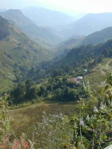
After crossing some beautiful countryside over rolling hills (well, shorter climbs than yesterday, anyway), we are met with a final steep climb into Angangueo. You will fall in love with this gorgeous old mining town, jammed into the folds of the high mountains - that is if you remember to bring a warm sweater. It's chilly up here.Day 9Angangueo to Valle de Bravo98km
Exhilarating views and climbing. First views of Volcán Nevado. Colonial town, lake [more]
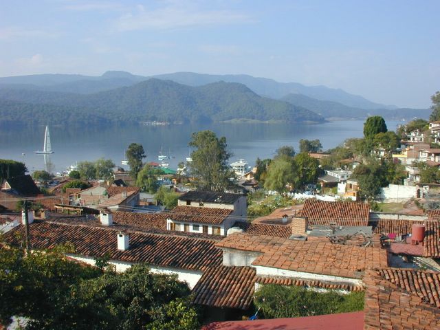
The climb out of Angangueo is the steepest of the tour. Climbing almost 750m in 8km, at times the grade is greater than 10%, so you may want to stop a few times on the way up. You could just say that you're just enjoying the view or checking out one of the variety of splendid wild mountain flowers on the way - it won't be hard to believe. Oh, did we mention that your bike should have a TRIPLE CHAINRING? After peaking at well over 3000m, the rolling descent will present our first view of the Volcán Nevado de Toluca. Valle is on the shores of an artificial lake that contributes to Mexico City's water supply. Conversly, Mexico City supplies most of the town's tourism as weekenders come to sail, waterski, hangglide, and mountain bike. Being a weekday, the town will be quiet for us to explore at our liesure. Hilly cobblestone streets, an excellent market and charming square are reminiscent of a typical southern Mediterranean village.Day 10Valle de Bravo-
Colonial lakeside town [more]
We'll take a well deserved rest here before heading to the volcano. Valle is on the shores of an artificial lake that contributes to Mexico City's water supply. Conversly, Mexico City supplies most of the town's tourism as weekenders come to sail, waterskii, hangglide, and mountain bike. Being a weekday, the town will be quiet for us to explore at our liesure. Hilly cobblestone streets, an excellent market and charming square are reminiscent of a typical southern Mediterranean village.Day 11Valle de Bravo to Volcán Nevado de Toluca69km
Pine forests, climb to Volcano 'base-camp'. [more]
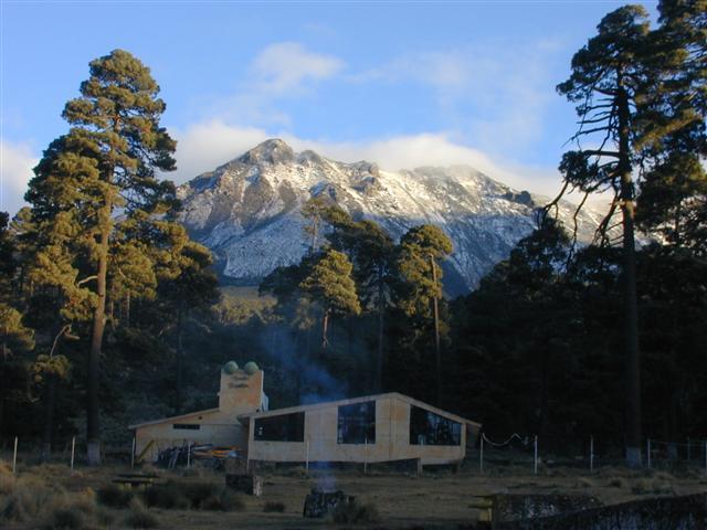
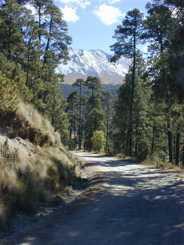
Today we'll climb to our 'base-camp' of the Volcán Nevado de Toluca (snowy volcano of Toluca). At 3700m we'll rest in our posada (inn) to prepare for tomorrow. You will need to have a sleeping bag as the posada does not supply blankets, and they don't call it 'nevado' (snowy) for nothing - there may be some snow on the ground!Day 12Volcán Nevado de Toluca35km
(altitude)
(altitude)
Climb to volcano crater at over 4200m! [more]
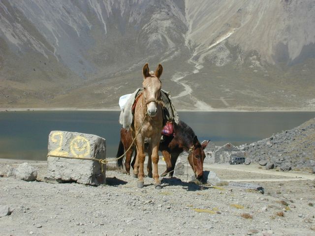
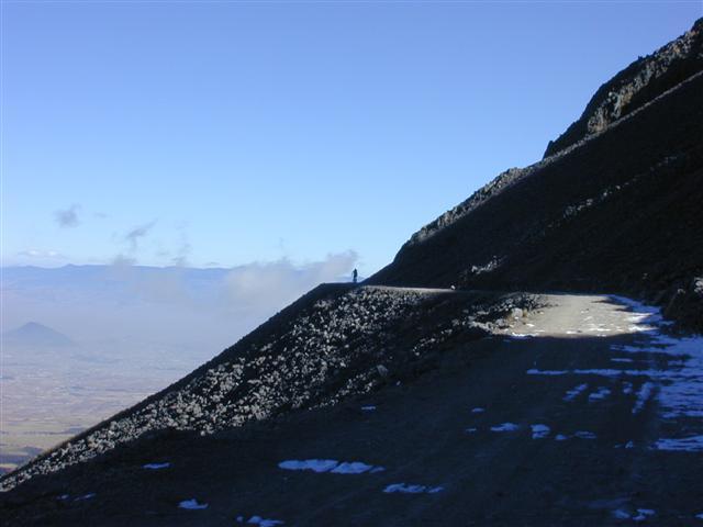
A dirt road will take us up to the crater's two lakes; El Sol and La Luna (sun and moon) at over 4200m elevation. If you have any breath left, try scrambling to the 4690m high peak of the extinct volcano. Xinantécatl as it was know in pre-hispanic times is very high and very cold - you will need warm clothes. There may be some snow on the ground, and there is a possibility that we will not allowed up the volcano if conditions are bad.Day 13Volcán Nevado de Toluca to Tonatico87km
Mostly downhill! Astounding scenery. Mineral baths [more]
Tonatico houses a mineral bath/fun park complex as well as a spectacular waterfall.Day 14Tonatico to Taxco64km
After the cave, well, what goes down must come up again - there's a long spectacular climb to Taxco. It's well worth the effort.
Canyon, MASSIVE cave, another great colonial town. [more]
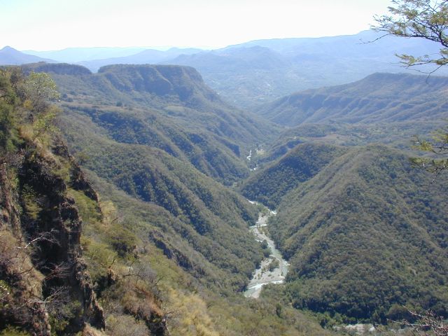
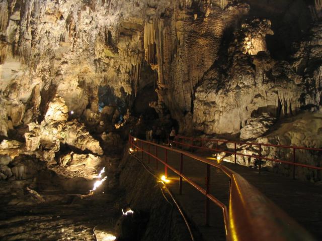
Don't let the distance fool you - this is a long day. Leaving Tonatico we will ride past the Barranca Grande canyon before we descend into the valley where the Grutas de Cacahuamilma (cave) is. This cave is like nothing you've ever seen before. We'll walk 2km into the cave along a lit path - the cave goes an estimated 4km further! The almost 100m (320ft) high chambres and almost 50m (160ft) high stalagmites are mind-boggling.After the cave, well, what goes down must come up again - there's a long spectacular climb to Taxco. It's well worth the effort.
Day 15Taxco-
Old silver mining town - a wonderful colonial antique [more]
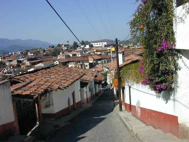
This is our last rest day before the push to the coast. It'll be hard to rest though because you'll want to spend every minute exploring this gem of a town. This place is truly three-dimensional! It's built on the side of a mountain and there are narrow alley-ways and stairways meandering this way and that, up and down. Go ahead, wonder around and get lost, it's not that big a town, you'll find your way back to the hotel before tomorrow. Also be sure to check out the markets - you may want to pick up some jumil beatles to snack on, or shop for some beautifully worked silver, a variety of stone and crystals, or any of the other fine crafts.Day 16Taxco to Teloloapan75km
Mountain scenery, small towns, marble street town - birthplace of Cuauhtémoc [more]
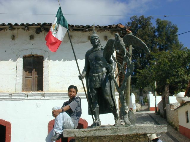
As we climb out of Taxco, we veer off from the main road and head towards higher ground. Finally we descend into Ixcateopan de Cuauhtémoc, the birthplace of Cuauhtémoc, the final Aztec emperor who was defeated and executed by Cortés. Due to the nearby quarries, the streets here are paved with marble! We will spend the night in the very inviting town of Teloloapan.Day 17Teloloapan to Ciudad Altamirano121km
Plenty of downhill. Changing scenery. [more]
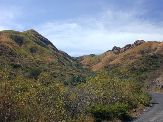
As we get closer to the ocean and closer to sea level, the days are warmer and nights not as cool. The vegetation changes completely in this area, we'll see a little more pine forest when we cross the last mountain range on our last day of riding, but from now on the vegetation is more arid and shrubby. The mountains take on a different character too looking older and more weathered here.Day 18Ciudad Altamirano-Rest day. Bustling city. Market, good food.
Day 19Cd. Altamirano to Camp101km
Challenging cycling, remote area, camping. [more]
Today we enter some very remote country. We'll see very few cars today, and very few people. Climbing over the last range of mountains before the coast, we're in for some challenging mountains. As we will be camping, we'll simply cycle until dusk and then look for a place to camp. Along the way we'll stop to eat, rest and marvel at the majestic scenery.Day 20Camp to Zihuatanejo102km
Mostly downhill, breathtaking scenery in very remote country. [more]
We'll finish climbing into the last pine forest that we'll see on this tour, and then drop down a fast beautiful descent into Vallecitos then onto Zihua.Day 21Zihuatanejo-
Beaches, handcrafts, market - Stay a bit longer or fly back home [more]
Zihuatanejo is Ixtapa's easy-going sibling. Only 8km away it still gets a lot of tourism but has a very different ambiance. Small-scale fishing is still important to the town's ecomony so seafood here is great. There are many good beaches, restaurants, bars and a very busy and colourful market.What it cost that season
| Guides' Fee | + Accommodations | + Food & Drink | + Misc. | = Approx. Total Land Cost |
|---|---|---|---|---|
| $500 | $160 | $250 | $85 | $995 |
All figures in US dollars, as published at the time. Riders paid their own accommodation, food and entrance fees on the road — the Guides' Fee was the only charge from ¡El Tour. Full history: price of Mountains & Natural Wonders through the years.
Photo Album